


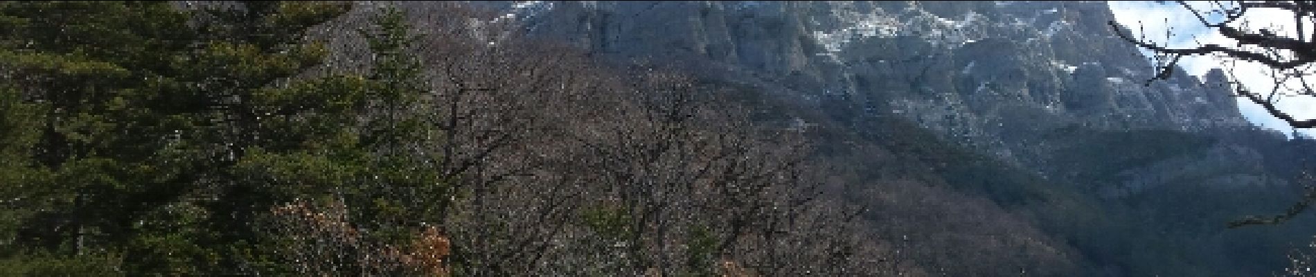
Abbaye de Valcroissant - 06 avril 15

morganee
User
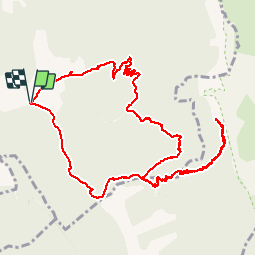

Length
13.6 km

Max alt
1537 m

Uphill gradient
1074 m
Km-Effort
28 km

Min alt
599 m

Downhill gradient
1076 m
Boucle
Yes
Creation date :
2019-07-19 19:06:10.347
Updated on :
2019-07-19 19:06:10.858
5h54
Difficulty : Difficult

FREE GPS app for hiking
 SityTrail
IGN / Geographical institutes
SityTrail Plus
The world is yours!
About
Trail Walking of 13.6 km to be discovered at Auvergne-Rhône-Alpes, Drôme, Die. This trail is proposed by morganee.
Photos


Positioning
Country:
France
Region :
Auvergne-Rhône-Alpes
Department/Province :
Drôme
Municipality :
Die
Location:
Unknown
Start:(Dec)
Start:(UTM)
692024 ; 4957160 (31T) N.
Comments