


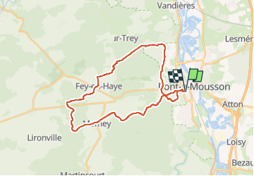
Fond des 4 vaux

PhilippeC54
User

Length
29 km

Max alt
374 m

Uphill gradient
544 m
Km-Effort
36 km

Min alt
178 m

Downhill gradient
544 m
Boucle
Yes
Creation date :
2025-01-04 12:32:57.499
Updated on :
2025-01-04 14:51:34.148
2h18
Difficulty : Medium

FREE GPS app for hiking
 SityTrail
IGN / Geographical institutes
SityTrail Plus
The world is yours!
About
Trail Mountain bike of 29 km to be discovered at Grand Est, Meurthe-et-Moselle, Pont-à-Mousson. This trail is proposed by PhilippeC54.
Positioning
Country:
France
Region :
Grand Est
Department/Province :
Meurthe-et-Moselle
Municipality :
Pont-à-Mousson
Location:
Unknown
Start:(Dec)
Start:(UTM)
283581 ; 5420465 (32U) N.
Comments