


grotte agusade

brandy
User

Length
404 m

Max alt
243 m

Uphill gradient
6 m
Km-Effort
480 m

Min alt
233 m

Downhill gradient
5 m
Boucle
Yes
Creation date :
2025-01-04 15:22:47.929
Updated on :
2025-01-04 15:45:58.766
9m
Difficulty : Easy

FREE GPS app for hiking
 SityTrail
IGN / Geographical institutes
SityTrail Plus
The world is yours!
About
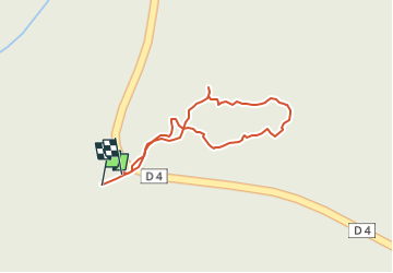
Trail Walking of 404 m to be discovered at Auvergne-Rhône-Alpes, Ardèche, Vallon-Pont-d'Arc. This trail is proposed by brandy.
Positioning
Country:
France
Region :
Auvergne-Rhône-Alpes
Department/Province :
Ardèche
Municipality :
Vallon-Pont-d'Arc
Location:
Unknown
Start:(Dec)
Start:(UTM)
613229 ; 4917981 (31T) N.
Comments