


Cani-Rando 2025

alfreson
User

Length
74 km

Max alt
495 m

Uphill gradient
938 m
Km-Effort
87 km

Min alt
224 m

Downhill gradient
1061 m
Boucle
No
Creation date :
2025-01-05 09:22:30.0
Updated on :
2025-01-05 12:55:40.186
3h32
Difficulty : Very difficult

FREE GPS app for hiking
 SityTrail
IGN / Geographical institutes
SityTrail Plus
The world is yours!
About
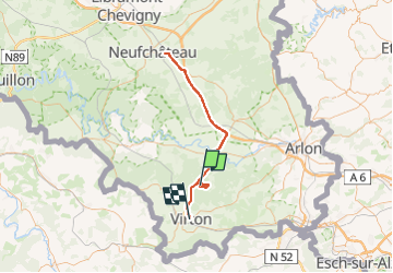
Trail Walking of 74 km to be discovered at Wallonia, Luxembourg, Virton. This trail is proposed by alfreson.
Description
À corriger, contient le trajet en voiture
Positioning
Country:
Belgium
Region :
Wallonia
Department/Province :
Luxembourg
Municipality :
Virton
Location:
Ethe
Start:(Dec)
Start:(UTM)
684552 ; 5499892 (31U) N.
Comments