


Ru de la Navette

jeanmarcMasson
User GUIDE
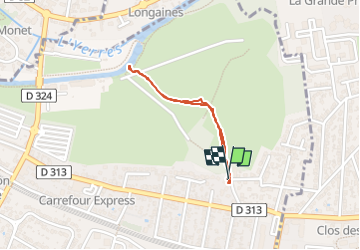

Length
1.2 km

Max alt
35 m

Uphill gradient
7 m
Km-Effort
1.3 km

Min alt
30 m

Downhill gradient
7 m
Boucle
Yes
Creation date :
2025-01-07 10:46:58.718
Updated on :
2025-01-07 11:08:58.694
18m
Difficulty : Easy

FREE GPS app for hiking
 SityTrail
IGN / Geographical institutes
SityTrail Plus
The world is yours!
About
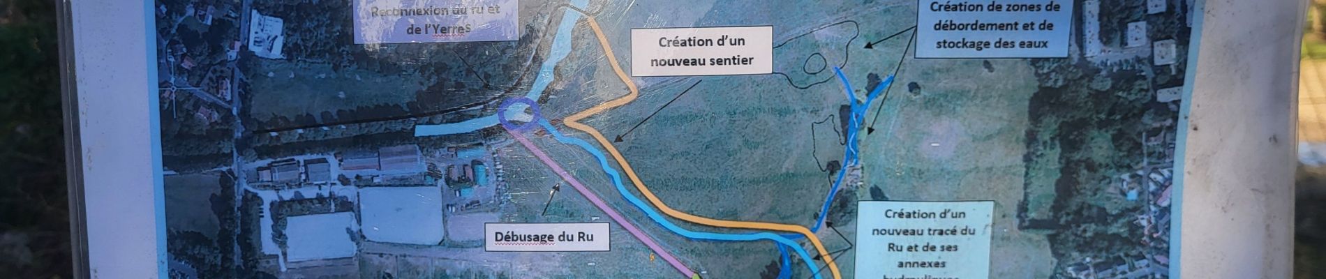
Trail Walking of 1.2 km to be discovered at Ile-de-France, Essonne, Montgeron. This trail is proposed by jeanmarcMasson.
Photos


Positioning
Country:
France
Region :
Ile-de-France
Department/Province :
Essonne
Municipality :
Montgeron
Location:
Unknown
Start:(Dec)
Start:(UTM)
461203 ; 5395135 (31U) N.
Comments