Coux

raygautier
User
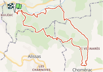

Length
14 km

Max alt
432 m

Uphill gradient
565 m
Km-Effort
22 km

Min alt
167 m

Downhill gradient
564 m
Boucle
Yes
Creation date :
2025-01-12 08:15:14.0
Updated on :
2025-01-12 14:44:58.473
6h20
Difficulty : Very difficult

FREE GPS app for hiking
 SityTrail
IGN / Geographical institutes
SityTrail Plus
The world is yours!
About
Trail Walking of 14 km to be discovered at Auvergne-Rhône-Alpes, Ardèche, Coux. This trail is proposed by raygautier.
Positioning
Country:
France
Region :
Auvergne-Rhône-Alpes
Department/Province :
Ardèche
Municipality :
Coux
Location:
Unknown
Start:(Dec)
Start:(UTM)
628336 ; 4954544 (31T) N.
Comments