


Les quatre clochers

c.chehere
User

Length
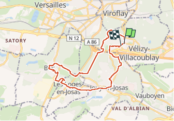
16.6 km

Max alt
187 m

Uphill gradient
276 m
Km-Effort
20 km

Min alt
88 m

Downhill gradient
277 m
Boucle
Yes
Creation date :
2025-01-13 07:32:15.651
Updated on :
2025-01-13 14:40:55.111
5h43
Difficulty : Medium

FREE GPS app for hiking
 SityTrail
IGN / Geographical institutes
SityTrail Plus
The world is yours!
About
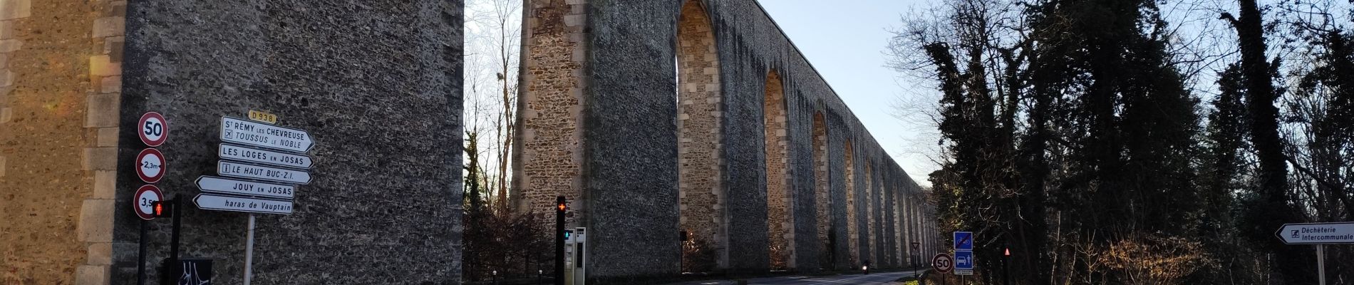
Trail Walking of 16.6 km to be discovered at Ile-de-France, Yvelines, Vélizy-Villacoublay. This trail is proposed by c.chehere.
Photos


Positioning
Country:
France
Region :
Ile-de-France
Department/Province :
Yvelines
Municipality :
Vélizy-Villacoublay
Location:
Unknown
Start:(Dec)
Start:(UTM)
439700 ; 5403888 (31U) N.
Comments