


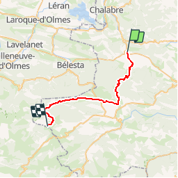
puivert à comus

dehemjacques
User

Length
31 km

Max alt
1374 m

Uphill gradient
1177 m
Km-Effort
44 km

Min alt
475 m

Downhill gradient
468 m
Boucle
No
Creation date :
2015-06-11 00:00:00.0
Updated on :
2015-06-11 00:00:00.0
8h05
Difficulty : Very difficult

FREE GPS app for hiking
 SityTrail
IGN / Geographical institutes
SityTrail Plus
The world is yours!
About
Trail Walking of 31 km to be discovered at Occitania, Aude, Puivert. This trail is proposed by dehemjacques.
Positioning
Country:
France
Region :
Occitania
Department/Province :
Aude
Municipality :
Puivert
Location:
Unknown
Start:(Dec)
Start:(UTM)
422301 ; 4752425 (31T) N.
Comments