


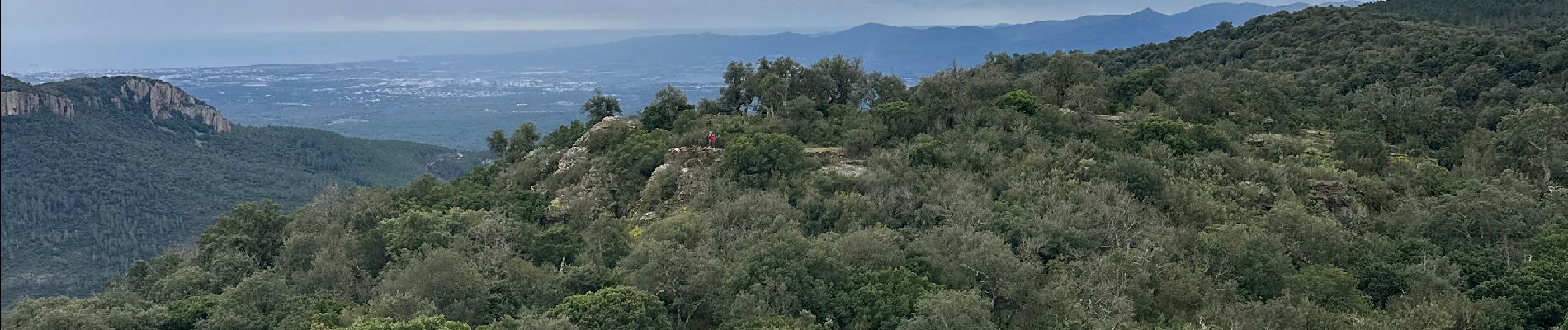
Gorges de Blavet pays de Fayence

alinetpierre
User
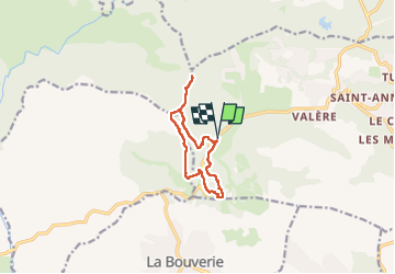

Length
10.2 km

Max alt
555 m

Uphill gradient
503 m
Km-Effort
16.9 km

Min alt
130 m

Downhill gradient
503 m
Boucle
Yes
Creation date :
2025-01-20 08:33:04.0
Updated on :
2025-01-21 08:16:41.093

FREE GPS app for hiking
 SityTrail
IGN / Geographical institutes
SityTrail Plus
The world is yours!
About
Trail of 10.2 km to be discovered at Provence-Alpes-Côte d'Azur, Var, Bagnols-en-Forêt. This trail is proposed by alinetpierre.
Description
Très bien balisée,
Photos


Positioning
Country:
France
Region :
Provence-Alpes-Côte d'Azur
Department/Province :
Var
Municipality :
Bagnols-en-Forêt
Location:
Unknown
Start:(Dec)
Start:(UTM)
310499 ; 4822209 (32T) N.
Comments