


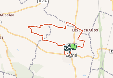
La balade de Ligné

alainjoseph6
User

Length
7.7 km

Max alt
117 m

Uphill gradient
74 m
Km-Effort
8.7 km

Min alt
64 m

Downhill gradient
77 m
Boucle
Yes
Creation date :
2025-01-23 12:55:20.05
Updated on :
2025-01-23 15:28:40.828
2h32
Difficulty : Medium

FREE GPS app for hiking
 SityTrail
IGN / Geographical institutes
SityTrail Plus
The world is yours!
About
Trail Walking of 7.7 km to be discovered at New Aquitaine, Charente, Ligné. This trail is proposed by alainjoseph6.
Description
Une balade sympathique avec les paysages charentais et les éoliennes.
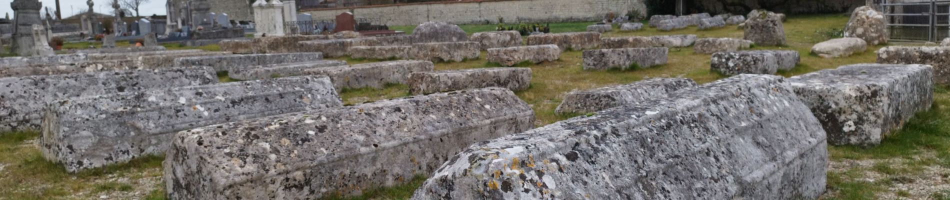
le cimetière médiéval avec 70 pierres tombale.
Photos


Positioning
Country:
France
Region :
New Aquitaine
Department/Province :
Charente
Municipality :
Ligné
Location:
Unknown
Start:(Dec)
Start:(UTM)
275822 ; 5089464 (31T) N.
Comments