


tricot à Châtel

CABERMAT
User

Length
55 km

Max alt
2231 m

Uphill gradient
5993 m
Km-Effort
135 km

Min alt
1119 m

Downhill gradient
5980 m
Boucle
Yes
Creation date :
2025-01-23 08:56:28.224
Updated on :
2025-01-23 17:28:01.389
6h08
Difficulty : Difficult

FREE GPS app for hiking
 SityTrail
IGN / Geographical institutes
SityTrail Plus
The world is yours!
About
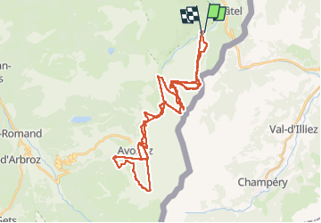
Trail Alpine skiing of 55 km to be discovered at Auvergne-Rhône-Alpes, Upper Savoy, Châtel. This trail is proposed by CABERMAT.
Positioning
Country:
France
Region :
Auvergne-Rhône-Alpes
Department/Province :
Upper Savoy
Municipality :
Châtel
Location:
Unknown
Start:(Dec)
Start:(UTM)
332239 ; 5124770 (32T) N.
Comments