


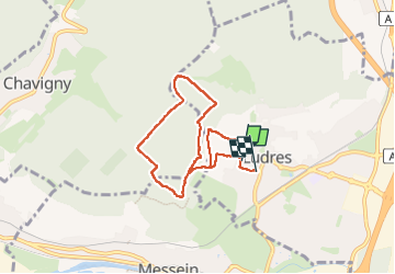
ludres coteaux

ISAGIL
User

Length
6.4 km

Max alt
423 m

Uphill gradient
167 m
Km-Effort
8.7 km

Min alt
292 m

Downhill gradient
182 m
Boucle
No
Creation date :
2025-01-28 13:09:04.923
Updated on :
2025-01-28 15:01:08.014
1h51
Difficulty : Medium

FREE GPS app for hiking
 SityTrail
IGN / Geographical institutes
SityTrail Plus
The world is yours!
About
Trail Walking of 6.4 km to be discovered at Grand Est, Meurthe-et-Moselle, Ludres. This trail is proposed by ISAGIL.
Description
ludres
Positioning
Country:
France
Region :
Grand Est
Department/Province :
Meurthe-et-Moselle
Municipality :
Ludres
Location:
Unknown
Start:(Dec)
Start:(UTM)
290490 ; 5389260 (32U) N.
Comments