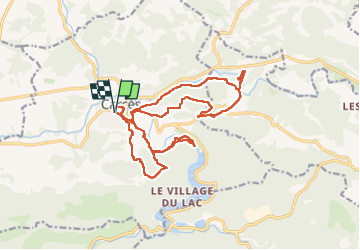
Trail Walking Carcès - Carces - Photo
 FSantoni
FSantoni

User

© OpenStreetMap contributors
Length
Length
21 km
Max alt
Max alt
252 m
Uphill gradient
Uphill gradient
379 m
Km-Effort
Km-Effort  
26 km
Min alt
Min alt
112 m
Downhill gradient
Downhill gradient
379 m
Boucle
Boucle
Yes
Creation date :
2025-01-29 08:08:30.474
Updated on :
2025-01-29 17:32:20.093

(0 Reviews)

Walking
Walking
6h24
Difficulty : Very difficult

Scan this QR Code to open this trail in the SityTrail application

FREE GPS app for hiking

Logo SityTrail SityTrail

IGN / Geographical institutes

Download SityTrail from the App Store Download SityTrail from Google Play

Logo SityTrail SityTrail Plus

The world is yours!

Download SityTrail from the App Store Download SityTrail from Google Play Download SityTrail on Huawei AppGallery

About

Trail Walking of 21 km to be discovered at Provence-Alpes-Côte d'Azur, Var, Carcès. This trail is proposed by FSantoni.

Description

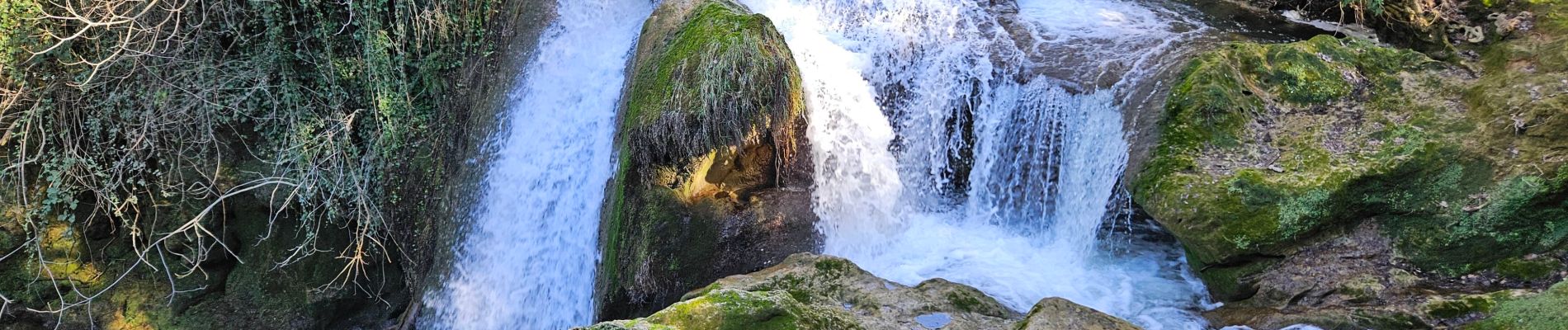
En partant de Carcès, une rando assez longue mais sans dénivelé conséquent. Quelques endroits vraiment beaux, comme des cheminements dans le vignoble local, les bords des rivières Argens et Caramy, des cascades fournies et quelques sentiers bucoliques. Par contre je déconseille le tracé dans sa globalité car trop de passages goudronnés, ce que je n'aime pas du tout.

Elevation profile

Photos

26 photos in total. Please click on a photo to see them all in the gallery.

Positioning

Country:
France
Region :
Provence-Alpes-Côte d'Azur
Department/Province :
Var
Municipality :
Carcès
Location:
Unknown
Start:(UTM)
271981 ; 4817302 (32T) N.


Close
My subscriptions