


beaulieue 9ème édition 2015

cath310
User
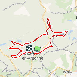

Length
19.3 km

Max alt
311 m

Uphill gradient
361 m
Km-Effort
24 km

Min alt
206 m

Downhill gradient
361 m
Boucle
Yes
Creation date :
2015-06-14 00:00:00.0
Updated on :
2015-06-14 00:00:00.0
5h15
Difficulty : Medium

FREE GPS app for hiking
 SityTrail
IGN / Geographical institutes
SityTrail Plus
The world is yours!
About
Trail Walking of 19.3 km to be discovered at Grand Est, Meuse, Beaulieu-en-Argonne. This trail is proposed by cath310.
Description
populaire tps indiqué avc pauses
Positioning
Country:
France
Region :
Grand Est
Department/Province :
Meuse
Municipality :
Beaulieu-en-Argonne
Location:
Unknown
Start:(Dec)
Start:(UTM)
651041 ; 5433046 (31U) N.
Comments