


hgg

sebastienu
User

Length
62 km

Max alt
137 m

Uphill gradient
577 m
Km-Effort
70 km

Min alt
0 m

Downhill gradient
634 m
Boucle
No
Creation date :
2025-01-14 15:25:02.932
Updated on :
2025-02-02 10:40:49.673
451h14
Difficulty : Very difficult

FREE GPS app for hiking
 SityTrail
IGN / Geographical institutes
SityTrail Plus
The world is yours!
About
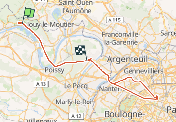
Trail Walking of 62 km to be discovered at Ile-de-France, Yvelines, Vaux-sur-Seine. This trail is proposed by sebastienu.
Positioning
Country:
France
Region :
Ile-de-France
Department/Province :
Yvelines
Municipality :
Vaux-sur-Seine
Location:
Unknown
Start:(Dec)
Start:(UTM)
423490 ; 5429378 (31U) N.
Comments