


T-A517-Le château de la Reine blanche

Jack-94
User
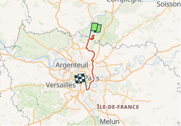

Length
75 km

Max alt
147 m

Uphill gradient
757 m
Km-Effort
85 km

Min alt
29 m

Downhill gradient
783 m
Boucle
No
Creation date :
2025-02-02 08:34:24.666
Updated on :
2025-02-03 14:29:02.626
9h31
Difficulty : Very difficult

FREE GPS app for hiking
 SityTrail
IGN / Geographical institutes
SityTrail Plus
The world is yours!
About
Trail Walking of 75 km to be discovered at Ile-de-France, Val-d'Oise, Chaumontel. This trail is proposed by Jack-94.
Positioning
Country:
France
Region :
Ile-de-France
Department/Province :
Val-d'Oise
Municipality :
Chaumontel
Location:
Unknown
Start:(Dec)
Start:(UTM)
459077 ; 5442363 (31U) N.
Comments