


mas Honorat Vers Trou du rat

denel
User

Length
29 km

Max alt
554 m

Uphill gradient
634 m
Km-Effort
38 km

Min alt
81 m

Downhill gradient
634 m
Boucle
Yes
Creation date :
2025-02-03 11:11:15.67
Updated on :
2025-02-03 14:36:42.817
3h24
Difficulty : Medium

FREE GPS app for hiking
 SityTrail
IGN / Geographical institutes
SityTrail Plus
The world is yours!
About
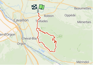
Trail Mountain bike of 29 km to be discovered at Provence-Alpes-Côte d'Azur, Vaucluse, Cavaillon. This trail is proposed by denel.
Positioning
Country:
France
Region :
Provence-Alpes-Côte d'Azur
Department/Province :
Vaucluse
Municipality :
Cavaillon
Location:
Unknown
Start:(Dec)
Start:(UTM)
667511 ; 4857230 (31T) N.
Comments