


20250105

fredodlageo
User
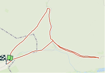

Length
5.7 km

Max alt
265 m

Uphill gradient
88 m
Km-Effort
6.9 km

Min alt
221 m

Downhill gradient
93 m
Boucle
Yes
Creation date :
2025-02-05 16:30:45.0
Updated on :
2025-02-05 17:09:13.534
38m
Difficulty : Unknown

FREE GPS app for hiking
 SityTrail
IGN / Geographical institutes
SityTrail Plus
The world is yours!
About
Trail Running of 5.7 km to be discovered at Grand Est, Bas-Rhin, Erckartswiller. This trail is proposed by fredodlageo.
Description
Cross seul😢
Positioning
Country:
France
Region :
Grand Est
Department/Province :
Bas-Rhin
Municipality :
Erckartswiller
Location:
Unknown
Start:(Dec)
Start:(UTM)
380922 ; 5415144 (32U) N.
Comments