


Monténégro J4

tyax93
User
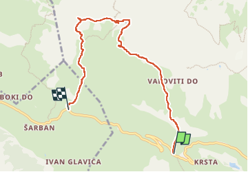

Length
8.1 km

Max alt
2157 m

Uphill gradient
410 m
Km-Effort
14.1 km

Min alt
1727 m

Downhill gradient
581 m
Boucle
No
Creation date :
2024-09-20 07:14:19.969
Updated on :
2025-02-09 13:20:18.709
3h08
Difficulty : Medium

FREE GPS app for hiking
 SityTrail
IGN / Geographical institutes
SityTrail Plus
The world is yours!
About
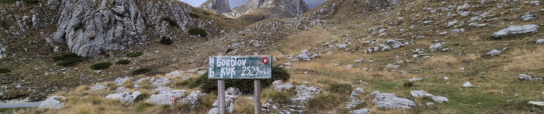
Trail Walking of 8.1 km to be discovered at Unknown, Žabljak Municipality. This trail is proposed by tyax93.
Photos


24 photos in total. Please click on a photo to see them all in the gallery.
Positioning
Country:
Montenegro
Region :
Unknown
Department/Province :
Žabljak Municipality
Municipality :
Unknown
Location:
Unknown
Start:(Dec)
Start:(UTM)
341391 ; 4773610 (34T) N.
Comments