


veurey voroize - tour de la cuche

maupassant38
User
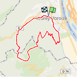

Length
9.4 km

Max alt
952 m

Uphill gradient
746 m
Km-Effort
19.4 km

Min alt
195 m

Downhill gradient
751 m
Boucle
Yes
Creation date :
2019-02-22 22:31:33.226
Updated on :
2019-02-22 22:31:33.261
3h51
Difficulty : Medium

FREE GPS app for hiking
 SityTrail
IGN / Geographical institutes
SityTrail Plus
The world is yours!
About
Trail Walking of 9.4 km to be discovered at Auvergne-Rhône-Alpes, Isère, Veurey-Voroize. This trail is proposed by maupassant38.
Positioning
Country:
France
Region :
Auvergne-Rhône-Alpes
Department/Province :
Isère
Municipality :
Veurey-Voroize
Location:
Unknown
Start:(Dec)
Start:(UTM)
704814 ; 5016568 (31T) N.
Comments