


boucle Chichiliane, Pas de l'Aiguille, Pas de l'Essaure

planets
User
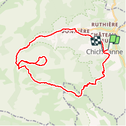

Length
22 km

Max alt
1845 m

Uphill gradient
1084 m
Km-Effort
37 km

Min alt
981 m

Downhill gradient
1075 m
Boucle
No
Creation date :
2015-06-20 00:00:00.0
Updated on :
2015-06-20 00:00:00.0
7h29
Difficulty : Medium

FREE GPS app for hiking
 SityTrail
IGN / Geographical institutes
SityTrail Plus
The world is yours!
About
Trail Walking of 22 km to be discovered at Auvergne-Rhône-Alpes, Isère, Chichilianne. This trail is proposed by planets.
Description
erreur de parcours au niveau de Chamailloux
Positioning
Country:
France
Region :
Auvergne-Rhône-Alpes
Department/Province :
Isère
Municipality :
Chichilianne
Location:
Unknown
Start:(Dec)
Start:(UTM)
703674 ; 4965311 (31T) N.
Comments