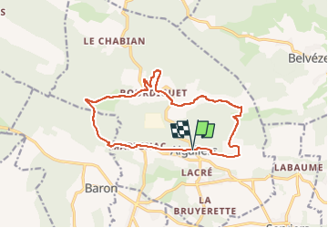
Aigaliers-Bourdiguet Pr01

GOIOLIRIBES
User

Length
15.4 km

Max alt
274 m

Uphill gradient
308 m
Km-Effort
19.5 km

Min alt
161 m

Downhill gradient
307 m
Boucle
Yes
Creation date :
2025-02-11 13:46:21.866
Updated on :
2025-02-11 13:47:44.366
4h25
Difficulty : Very difficult

FREE GPS app for hiking
 SityTrail
IGN / Geographical institutes
SityTrail Plus
The world is yours!
About
Trail Walking of 15.4 km to be discovered at Occitania, Gard, Aigaliers. This trail is proposed by GOIOLIRIBES.
Description
départ Aigaliers -
Positioning
Country:
France
Region :
Occitania
Department/Province :
Gard
Municipality :
Aigaliers
Location:
Unknown
Start:(Dec)
Start:(UTM)
605771 ; 4879298 (31T) N.
Comments