


Causse Noir

Tommy Eric
User
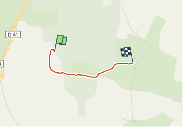

Length
1.6 km

Max alt
891 m

Uphill gradient
55 m
Km-Effort
2.2 km

Min alt
839 m

Downhill gradient
13 m
Boucle
No
Creation date :
2025-02-12 14:25:40.003
Updated on :
2025-02-12 15:09:10.738
43m
Difficulty : Easy

FREE GPS app for hiking
 SityTrail
IGN / Geographical institutes
SityTrail Plus
The world is yours!
About
Trail Walking of 1.6 km to be discovered at Occitania, Aveyron, Saint-André-de-Vézines. This trail is proposed by Tommy Eric.
Description
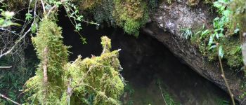
Petite rando vers Aven
Photos

Positioning
Country:
France
Region :
Occitania
Department/Province :
Aveyron
Municipality :
Saint-André-de-Vézines
Location:
Unknown
Start:(Dec)
Start:(UTM)
522029 ; 4887953 (31T) N.
Comments