


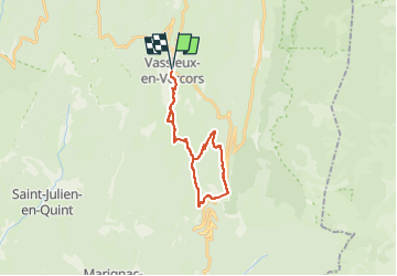
vassieux col de rousset aller retour

brandy
User

Length
22 km

Max alt
1464 m

Uphill gradient
825 m
Km-Effort
33 km

Min alt
1056 m

Downhill gradient
825 m
Boucle
Yes
Creation date :
2025-02-12 21:36:31.579
Updated on :
2025-02-12 21:36:34.126
7h35
Difficulty : Very difficult

FREE GPS app for hiking
 SityTrail
IGN / Geographical institutes
SityTrail Plus
The world is yours!
About
Trail Walking of 22 km to be discovered at Auvergne-Rhône-Alpes, Drôme, Vassieux-en-Vercors. This trail is proposed by brandy.
Positioning
Country:
France
Region :
Auvergne-Rhône-Alpes
Department/Province :
Drôme
Municipality :
Vassieux-en-Vercors
Location:
Unknown
Start:(Dec)
Start:(UTM)
687221 ; 4974070 (31T) N.
Comments