


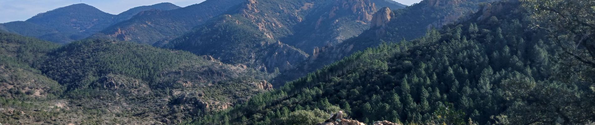
Tour du Pic du Perthus Occidental

Pascal-83
User
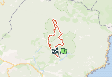

Length
11 km

Max alt
208 m

Uphill gradient
218 m
Km-Effort
13.9 km

Min alt
40 m

Downhill gradient
218 m
Boucle
Yes
Creation date :
2025-02-13 07:19:35.439
Updated on :
2025-02-19 19:47:27.967
3h34
Difficulty : Easy

FREE GPS app for hiking
 SityTrail
IGN / Geographical institutes
SityTrail Plus
The world is yours!
About
Trail Walking of 11 km to be discovered at Provence-Alpes-Côte d'Azur, Var, Saint-Raphaël. This trail is proposed by Pascal-83.
Description
marche Roquebrune Amitié
Photos


Positioning
Country:
France
Region :
Provence-Alpes-Côte d'Azur
Department/Province :
Var
Municipality :
Saint-Raphaël
Location:
Unknown
Start:(Dec)
Start:(UTM)
327560 ; 4813695 (32T) N.
Comments