


20250213-bonsecours

doudet
User
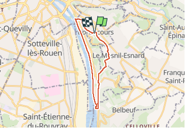

Length
11 km

Max alt
154 m

Uphill gradient
211 m
Km-Effort
13.8 km

Min alt
2 m

Downhill gradient
211 m
Boucle
Yes
Creation date :
2025-02-13 12:53:44.413
Updated on :
2025-02-14 07:21:59.676
3h22
Difficulty : Medium

FREE GPS app for hiking
 SityTrail
IGN / Geographical institutes
SityTrail Plus
The world is yours!
About
Trail Walking of 11 km to be discovered at Normandy, Seine-Maritime, Bonsecours. This trail is proposed by doudet.
Description
Boucle A-R au départ de la Basilique
Photos

Positioning
Country:
France
Region :
Normandy
Department/Province :
Seine-Maritime
Municipality :
Bonsecours
Location:
Unknown
Start:(Dec)
Start:(UTM)
363918 ; 5476026 (31U) N.
Comments