


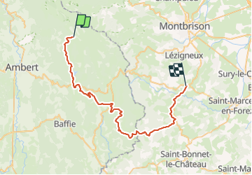
Col des Supeyres - La Chaulme

ramsay
User

Length
48 km

Max alt
1389 m

Uphill gradient
1029 m
Km-Effort
64 km

Min alt
631 m

Downhill gradient
1752 m
Boucle
No
Creation date :
2015-06-20 00:00:00.0
Updated on :
2015-06-20 00:00:00.0
3h59
Difficulty : Difficult

FREE GPS app for hiking
 SityTrail
IGN / Geographical institutes
SityTrail Plus
The world is yours!
About
Trail Mountain bike of 48 km to be discovered at Auvergne-Rhône-Alpes, Puy-de-Dôme, Valcivières. This trail is proposed by ramsay.
Positioning
Country:
France
Region :
Auvergne-Rhône-Alpes
Department/Province :
Puy-de-Dôme
Municipality :
Valcivières
Location:
Unknown
Start:(Dec)
Start:(UTM)
565962 ; 5049124 (31T) N.
Comments