


Mad_39_PicoRuivo

jeanmarcMasson
User GUIDE
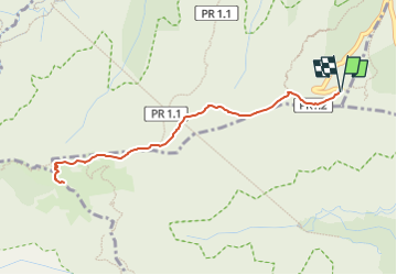

Length
5.3 km

Max alt
1867 m

Uphill gradient
364 m
Km-Effort
10.2 km

Min alt
1587 m

Downhill gradient
364 m
Boucle
Yes
Creation date :
2025-02-17 20:22:40.36
Updated on :
2025-02-27 08:04:45.26
2h19
Difficulty : Medium

FREE GPS app for hiking
 SityTrail
IGN / Geographical institutes
SityTrail Plus
The world is yours!
About
Trail Walking of 5.3 km to be discovered at Madeira, Unknown, Ilha. This trail is proposed by jeanmarcMasson.


Positioning
Country:
Portugal
Region :
Madeira
Department/Province :
Unknown
Municipality :
Ilha
Location:
Unknown
Start:(Dec)
Start:(UTM)
320054 ; 3626852 (28S) N.
Comments