


170225

arnoultjf
User

Length
11.7 km

Max alt
246 m

Uphill gradient
182 m
Km-Effort
14.1 km

Min alt
169 m

Downhill gradient
182 m
Boucle
Yes
Creation date :
2025-02-18 12:50:31.491
Updated on :
2025-02-18 15:56:13.395
3h03
Difficulty : Difficult

FREE GPS app for hiking
 SityTrail
IGN / Geographical institutes
SityTrail Plus
The world is yours!
About
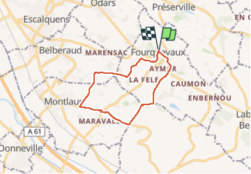
Trail Walking of 11.7 km to be discovered at Occitania, Haute-Garonne, Fourquevaux. This trail is proposed by arnoultjf.
Positioning
Country:
France
Region :
Occitania
Department/Province :
Haute-Garonne
Municipality :
Fourquevaux
Location:
Unknown
Start:(Dec)
Start:(UTM)
388280 ; 4818066 (31T) N.
Comments