


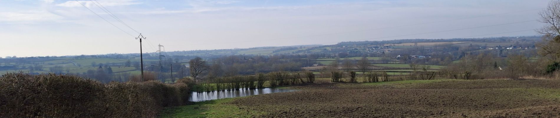
Wignehies Points de vue et paysage

mjh
User
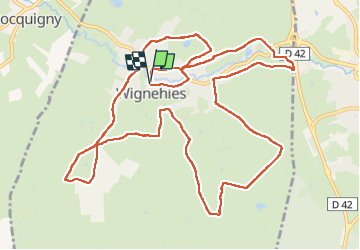

Length
13.9 km

Max alt
225 m

Uphill gradient
197 m
Km-Effort
16.5 km

Min alt
169 m

Downhill gradient
195 m
Boucle
Yes
Creation date :
2025-02-19 09:24:43.689
Updated on :
2025-02-19 13:42:30.029
3h27
Difficulty : Difficult

FREE GPS app for hiking
 SityTrail
IGN / Geographical institutes
SityTrail Plus
The world is yours!
About
Trail Walking of 13.9 km to be discovered at Hauts-de-France, Nord, Wignehies. This trail is proposed by mjh.
Photos

Positioning
Country:
France
Region :
Hauts-de-France
Department/Province :
Nord
Municipality :
Wignehies
Location:
Unknown
Start:(Dec)
Start:(UTM)
571926 ; 5540792 (31U) N.
Comments