


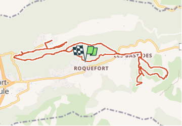
Roquefort la Bédoule

FSantoni
User


6h17
Difficulty : Very difficult

FREE GPS app for hiking
 SityTrail
IGN / Geographical institutes
SityTrail Plus
The world is yours!
About
Trail Walking of 17.3 km to be discovered at Provence-Alpes-Côte d'Azur, Bouches-du-Rhône, Roquefort-la-Bédoule. This trail is proposed by FSantoni.
Description
Au départ du cimetière de Roquefort la Bédoule, un parcours chaotique, assez loin du projet initial, avec trois allers-retours jamais agréables aux randonneurs !
La cause principale en est le grand nombre de chemins, pourtant balisés, qui sont fermés, quasi barricadés, sans que ces particularités ne soient mentionnées sur les applis classiques comme Visio rando ou Sity trail.
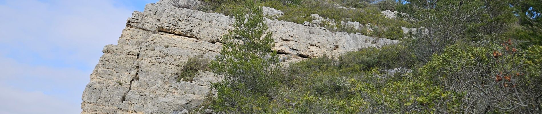
On est quand même montés jusqu'à la chapelle Saint André, avec une vue magnifique sur la sainte Baume.
Photos


Positioning
Comments