


Maury boucle

robertperello
User
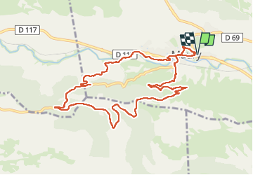

Length
11.8 km

Max alt
395 m

Uphill gradient
329 m
Km-Effort
16.2 km

Min alt
148 m

Downhill gradient
329 m
Boucle
Yes
Creation date :
2025-02-26 08:30:05.0
Updated on :
2025-02-26 13:55:15.436
3h20
Difficulty : Easy

FREE GPS app for hiking
 SityTrail
IGN / Geographical institutes
SityTrail Plus
The world is yours!
About
Trail Walking of 11.8 km to be discovered at Occitania, Pyrénées-Orientales, Maury. This trail is proposed by robertperello.
Description
Rando facile parking à la pharmacie
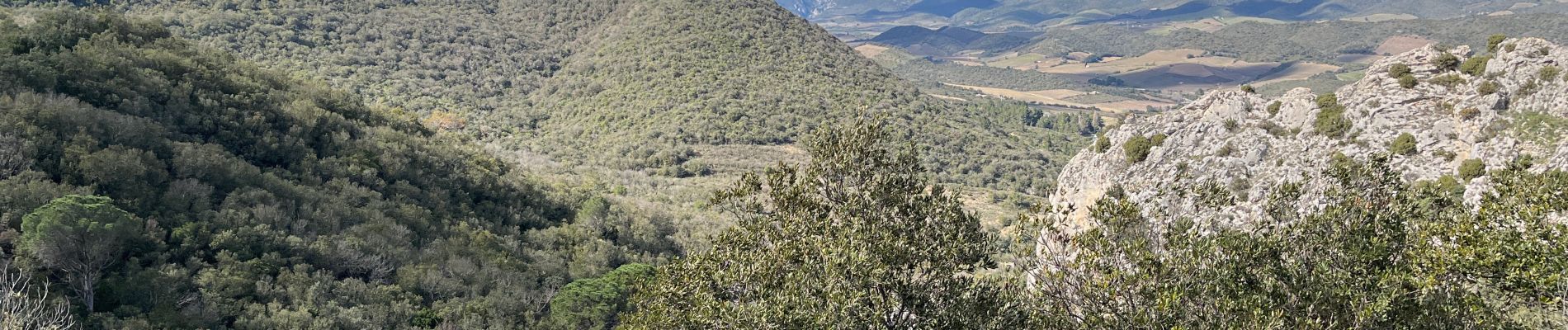
Photos


Positioning
Country:
France
Region :
Occitania
Department/Province :
Pyrénées-Orientales
Municipality :
Maury
Location:
Unknown
Start:(Dec)
Start:(UTM)
467002 ; 4739812 (31T) N.
Comments