Trail Walking Obernai - Obernai-150623 - VVF-Bischenberg - Photo

Obernai-150623 - VVF-Bischenberg

 randodan
randodan

User

© OpenStreetMap contributors
Length
Length
10.3 km
Max alt
Max alt
362 m
Uphill gradient
Uphill gradient
254 m
Km-Effort
Km-Effort  
13.7 km
Min alt
Min alt
188 m
Downhill gradient
Downhill gradient
252 m
Boucle
Boucle
Yes
Creation date :
2015-06-26 00:00:00.0
Updated on :
2015-06-26 00:00:00.0

(1 Reviews)

Walking
Walking
2h40
Difficulty : Easy

Scan this QR Code to open this trail in the SityTrail application

FREE GPS app for hiking

Logo SityTrail SityTrail

IGN / Geographical institutes

Download SityTrail from the App Store Download SityTrail from Google Play

Logo SityTrail SityTrail Plus

The world is yours!

Download SityTrail from the App Store Download SityTrail from Google Play Download SityTrail on Huawei AppGallery

About

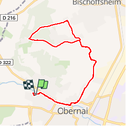
Trail Walking of 10.3 km to be discovered at Grand Est, Bas-Rhin, Obernai. This trail is proposed by randodan.

Description

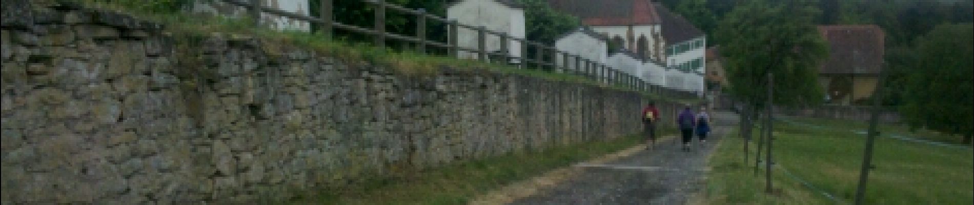
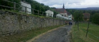
Obernais, 23 juin 2015<br>
- Couvent du Bischenberg, Le Kilbs -<br>
(d'après la fiche VVF Rando.2)<br>
8h50, départ du VVF.<br>
Personne ne veut l'escalier pour démarrer, alors, bitume-bitume . Au Couvent du Bischenberg, très beau Chemin de Croix.<br>
Une petite erreur d'interprétation de la description (fiche) à l'entrée dans Kilbs nous fait rater le chemin du Mont National, et à la place, c'est bitume-bitume :o(. Confusion aussi sur la fiche qui mélange l'escalier et le passage par la route du bas.<br>
Retour bitume-bitume ; 11h30 au VVF.<br>
5 participants (Jo,Ca,Ja,Chan,Da).

Elevation profile

Photos

Points of interest

Point of interest Bischoffsheim - 01 - Le Couvent du Bischenberg et son Chemin de Croix - Photo
randodan

Positioning

Country:
France
Region :
Grand Est
Department/Province :
Bas-Rhin
Municipality :
Obernai
Location:
Unknown
Start:(UTM)
386830 ; 5369235 (32U) N.

Comments

Please log in to post a review or rate the element


intéressant


Close
My subscriptions