


R1TA517-Autour de Coquibus

Jack-94
User

Length
78 km

Max alt
136 m

Uphill gradient
797 m
Km-Effort
88 km

Min alt
30 m

Downhill gradient
842 m
Boucle
No
Creation date :
2025-03-02 08:30:49.965
Updated on :
2025-03-03 10:40:33.067
12h17
Difficulty : Very difficult

FREE GPS app for hiking
 SityTrail
IGN / Geographical institutes
SityTrail Plus
The world is yours!
About
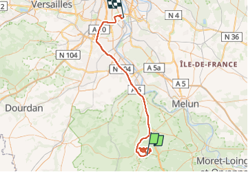
Trail Walking of 78 km to be discovered at Ile-de-France, Essonne, Milly-la-Forêt. This trail is proposed by Jack-94.

Positioning
Country:
France
Region :
Ile-de-France
Department/Province :
Essonne
Municipality :
Milly-la-Forêt
Location:
Unknown
Start:(Dec)
Start:(UTM)
463575 ; 5361456 (31U) N.
Comments