


Sainte victoire

raygautier
User

Length
10.2 km

Max alt
998 m

Uphill gradient
700 m
Km-Effort
19.4 km

Min alt
347 m

Downhill gradient
668 m
Boucle
No
Creation date :
2025-03-05 09:34:53.0
Updated on :
2025-03-05 16:02:48.747
6h18
Difficulty : Very difficult

FREE GPS app for hiking
 SityTrail
IGN / Geographical institutes
SityTrail Plus
The world is yours!
About
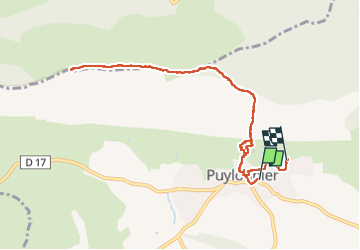
Trail Walking of 10.2 km to be discovered at Provence-Alpes-Côte d'Azur, Bouches-du-Rhône, Puyloubier. This trail is proposed by raygautier.
Positioning
Country:
France
Region :
Provence-Alpes-Côte d'Azur
Department/Province :
Bouches-du-Rhône
Municipality :
Puyloubier
Location:
Unknown
Start:(Dec)
Start:(UTM)
716376 ; 4822638 (31T) N.
Comments