


a revoir

brandy
User
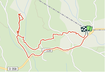

Length
3.1 km

Max alt
248 m

Uphill gradient
45 m
Km-Effort
3.7 km

Min alt
216 m

Downhill gradient
46 m
Boucle
Yes
Creation date :
2025-03-09 09:36:50.475
Updated on :
2025-03-09 10:44:57.009
56m
Difficulty : Easy

FREE GPS app for hiking
 SityTrail
IGN / Geographical institutes
SityTrail Plus
The world is yours!
About
Trail Walking of 3.1 km to be discovered at Auvergne-Rhône-Alpes, Ardèche, Saint-Marcel-d'Ardèche. This trail is proposed by brandy.
Positioning
Country:
France
Region :
Auvergne-Rhône-Alpes
Department/Province :
Ardèche
Municipality :
Saint-Marcel-d'Ardèche
Location:
Unknown
Start:(Dec)
Start:(UTM)
626832 ; 4912901 (31T) N.
Comments