


Stavelot 13 Km

Efr
User
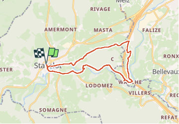

Length
13 km

Max alt
428 m

Uphill gradient
328 m
Km-Effort
17.4 km

Min alt
276 m

Downhill gradient
330 m
Boucle
Yes
Creation date :
2025-03-11 09:32:08.0
Updated on :
2025-03-11 16:59:16.52
3h57
Difficulty : Difficult

FREE GPS app for hiking
 SityTrail
IGN / Geographical institutes
SityTrail Plus
The world is yours!
About
Trail Walking of 13 km to be discovered at Wallonia, Liège, Stavelot. This trail is proposed by Efr.
Description
Départ: Place Saint remacle 4970 Stavelot
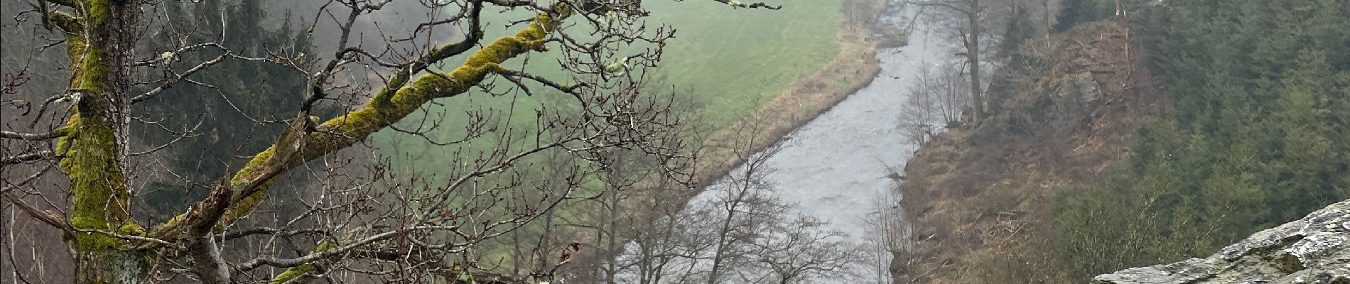
Photos


Positioning
Country:
Belgium
Region :
Wallonia
Department/Province :
Liège
Municipality :
Stavelot
Location:
Unknown
Start:(Dec)
Start:(UTM)
708237 ; 5586651 (31U) N.
Comments