


J.Sarment camping cafe Nesle

avdem
User

Length
13.5 km

Max alt
118 m

Uphill gradient
162 m
Km-Effort
15.8 km

Min alt
25 m

Downhill gradient
206 m
Boucle
No
Creation date :
2025-03-13 08:19:36.794
Updated on :
2025-03-13 11:52:29.136
3h31
Difficulty : Easy

FREE GPS app for hiking
 SityTrail
IGN / Geographical institutes
SityTrail Plus
The world is yours!
About
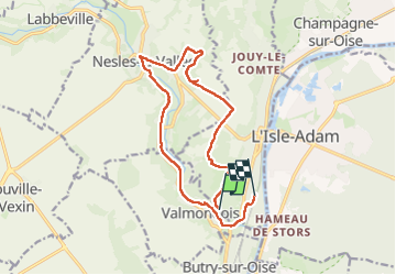
Trail Walking of 13.5 km to be discovered at Ile-de-France, Val-d'Oise, Parmain. This trail is proposed by avdem.
Description
Facile
Positioning
Country:
France
Region :
Ile-de-France
Department/Province :
Val-d'Oise
Municipality :
Parmain
Location:
Unknown
Start:(Dec)
Start:(UTM)
441226 ; 5438612 (31U) N.
Comments