


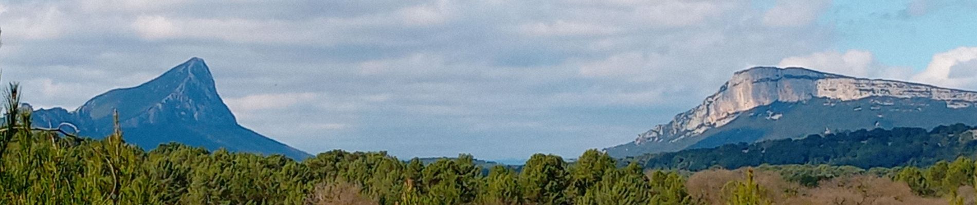
St Mathieu de Trevier -Lac de céréales GG

Dupuybadonniere
User
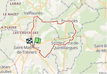

Length
15.6 km

Max alt
194 m

Uphill gradient
278 m
Km-Effort
19.3 km

Min alt
96 m

Downhill gradient
277 m
Boucle
Yes
Creation date :
2025-03-18 08:10:55.781
Updated on :
2025-03-18 11:49:20.131
3h06
Difficulty : Very difficult

FREE GPS app for hiking
 SityTrail
IGN / Geographical institutes
SityTrail Plus
The world is yours!
About
Trail Walking of 15.6 km to be discovered at Occitania, Hérault, Saint-Mathieu-de-Tréviers. This trail is proposed by Dupuybadonniere.
Photos

Positioning
Country:
France
Region :
Occitania
Department/Province :
Hérault
Municipality :
Saint-Mathieu-de-Tréviers
Location:
Unknown
Start:(Dec)
Start:(UTM)
570244 ; 4846869 (31T) N.
Comments