


angre

Bruno Carlier
User
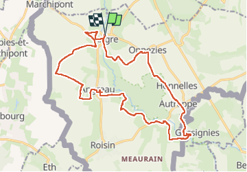

Length
19.7 km

Max alt
112 m

Uphill gradient
270 m
Km-Effort
23 km

Min alt
35 m

Downhill gradient
270 m
Boucle
Yes
Creation date :
2021-01-10 10:02:03.305
Updated on :
2025-03-20 09:46:56.959
4h36
Difficulty : Very easy

FREE GPS app for hiking
 SityTrail
IGN / Geographical institutes
SityTrail Plus
The world is yours!
About
Trail Walking of 19.7 km to be discovered at Wallonia, Hainaut, Honnelles. This trail is proposed by Bruno Carlier.
Description
super
Positioning
Country:
Belgium
Region :
Wallonia
Department/Province :
Hainaut
Municipality :
Honnelles
Location:
Unknown
Start:(Dec)
Start:(UTM)
549438 ; 5579810 (31U) N.
Comments