


Tour dans La Rochette

psyberty
User
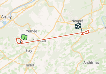

Length
17.6 km

Max alt
269 m

Uphill gradient
320 m
Km-Effort
22 km

Min alt
135 m

Downhill gradient
336 m
Boucle
No
Creation date :
2025-03-23 11:48:29.776
Updated on :
2025-03-23 12:20:54.25
4h58
Difficulty : Very difficult

FREE GPS app for hiking
 SityTrail
IGN / Geographical institutes
SityTrail Plus
The world is yours!
About
Trail Walking of 17.6 km to be discovered at Wallonia, Liège, Nandrin. This trail is proposed by psyberty.
Description
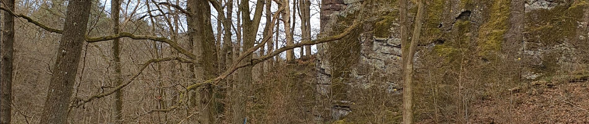
Le long d'un ruisseau jusqu'au Rocher de la Rochette, site néolithique. A faire par temps sec.
Photos

Positioning
Country:
Belgium
Region :
Wallonia
Department/Province :
Liège
Municipality :
Nandrin
Location:
Unknown
Start:(Dec)
Start:(UTM)
667055 ; 5597879 (31U) N.
Comments