


petite boucle de La Rochette et du ruisseau du Fond d'Oxhe

psyberty
User
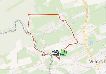

Length
3.4 km

Max alt
236 m

Uphill gradient
76 m
Km-Effort
4.4 km

Min alt
184 m

Downhill gradient
75 m
Boucle
Yes
Creation date :
2025-03-23 17:05:40.158
Updated on :
2025-03-23 17:09:18.382
1h00
Difficulty : Easy

FREE GPS app for hiking
 SityTrail
IGN / Geographical institutes
SityTrail Plus
The world is yours!
About
Trail Walking of 3.4 km to be discovered at Wallonia, Liège, Nandrin. This trail is proposed by psyberty.
Description
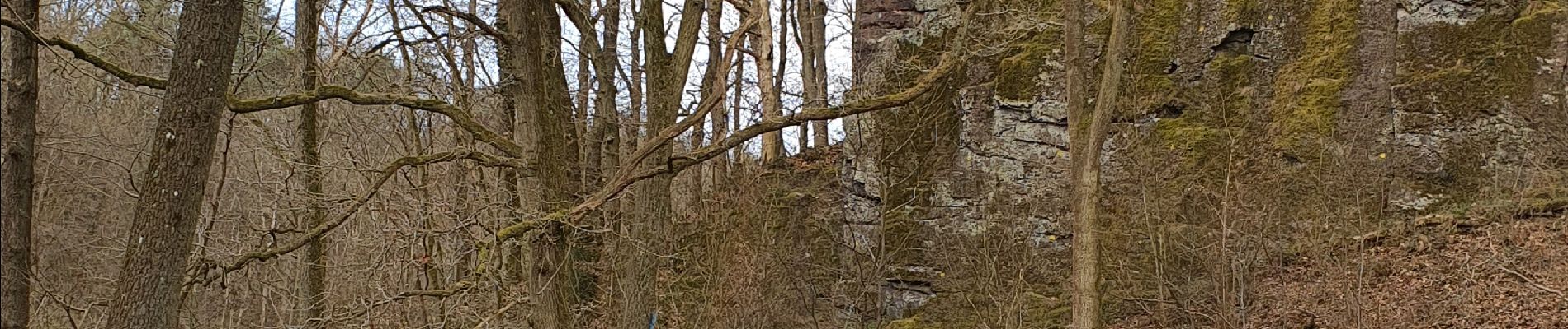
Belle promenade jusqu'au rocher de La Rochette (voir photo), site du noélithique et remontée par le bois de Bourgogne.
A éviter par temps humide le long du ruisseau.
Photos

Positioning
Country:
Belgium
Region :
Wallonia
Department/Province :
Liège
Municipality :
Nandrin
Location:
Unknown
Start:(Dec)
Start:(UTM)
667108 ; 5597827 (31U) N.
Comments