


trail du donon

Titinechris
User
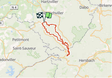

Length
43 km

Max alt
996 m

Uphill gradient
1224 m
Km-Effort
59 km

Min alt
305 m

Downhill gradient
1246 m
Boucle
Yes
Creation date :
2025-03-26 18:43:13.265
Updated on :
2025-03-26 18:43:16.416
7h00
Difficulty : Medium

FREE GPS app for hiking
 SityTrail
IGN / Geographical institutes
SityTrail Plus
The world is yours!
About
Trail Trail of 43 km to be discovered at Grand Est, Moselle, Saint-Quirin. This trail is proposed by Titinechris.
Positioning
Country:
France
Region :
Grand Est
Department/Province :
Moselle
Municipality :
Saint-Quirin
Location:
Unknown
Start:(Dec)
Start:(UTM)
357194 ; 5385839 (32U) N.
Comments