


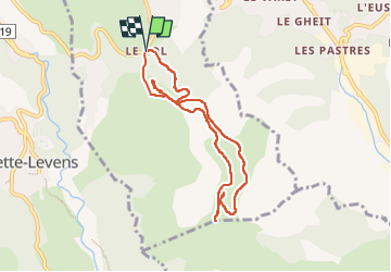
Les Crêtes du Mont Macaron et Châteauneuf-Villevielle

franquen
User

Length
8 km

Max alt
793 m

Uphill gradient
240 m
Km-Effort
11.2 km

Min alt
611 m

Downhill gradient
241 m
Boucle
Yes
Creation date :
2025-03-27 09:13:21.239
Updated on :
2025-03-27 15:56:57.971
2h32
Difficulty : Medium

FREE GPS app for hiking
 SityTrail
IGN / Geographical institutes
SityTrail Plus
The world is yours!
About
Trail Walking of 8 km to be discovered at Provence-Alpes-Côte d'Azur, Maritime Alps, Châteauneuf-Villevieille. This trail is proposed by franquen.
Positioning
Country:
France
Region :
Provence-Alpes-Côte d'Azur
Department/Province :
Maritime Alps
Municipality :
Châteauneuf-Villevieille
Location:
Unknown
Start:(Dec)
Start:(UTM)
362670 ; 4851117 (32T) N.
Comments