


Somme-Fort Mahon et Quend

nicolas54230
User

Length
11.5 km

Max alt
17 m

Uphill gradient
66 m
Km-Effort
12.3 km

Min alt
0 m

Downhill gradient
63 m
Boucle
Yes
Creation date :
2025-03-30 15:38:50.173
Updated on :
2025-03-30 15:39:29.653
2h48
Difficulty : Difficult

FREE GPS app for hiking
 SityTrail
IGN / Geographical institutes
SityTrail Plus
The world is yours!
About
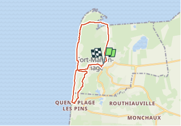
Trail Walking of 11.5 km to be discovered at Hauts-de-France, Somme, Fort-Mahon-Plage. This trail is proposed by nicolas54230.
Positioning
Country:
France
Region :
Hauts-de-France
Department/Province :
Somme
Municipality :
Fort-Mahon-Plage
Location:
Unknown
Start:(Dec)
Start:(UTM)
398131 ; 5577610 (31U) N.
Comments