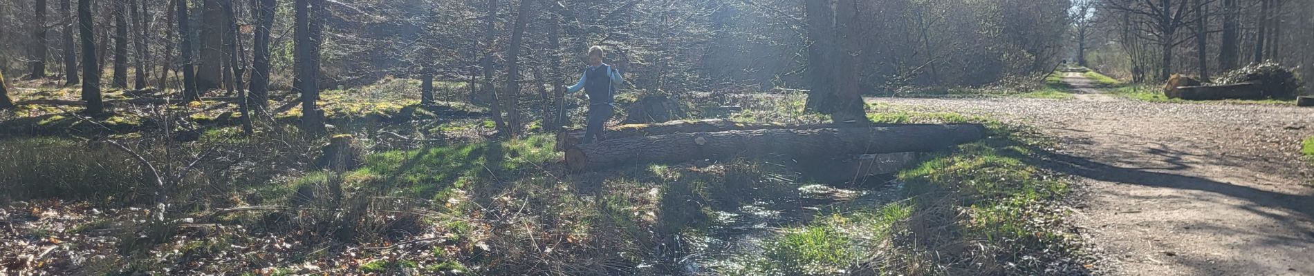
MN forêt de Sénart

jeanmarcMasson
User GUIDE
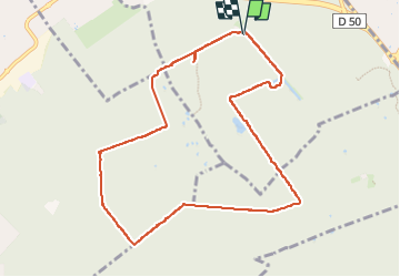

Length
9.3 km

Max alt
95 m

Uphill gradient
55 m
Km-Effort
10 km

Min alt
82 m

Downhill gradient
53 m
Boucle
Yes
Creation date :
2025-03-31 07:34:01.975
Updated on :
2025-03-31 09:21:19.338
1h33
Difficulty : Very easy

FREE GPS app for hiking
 SityTrail
IGN / Geographical institutes
SityTrail Plus
The world is yours!
About
Trail Nordic walking of 9.3 km to be discovered at Ile-de-France, Essonne, Montgeron. This trail is proposed by jeanmarcMasson.
Photos


Positioning
Country:
France
Region :
Ile-de-France
Department/Province :
Essonne
Municipality :
Montgeron
Location:
Unknown
Start:(Dec)
Start:(UTM)
460751 ; 5392702 (31U) N.
Comments