


frejus/ambon gardiette variante

Michel DUBOIS
User
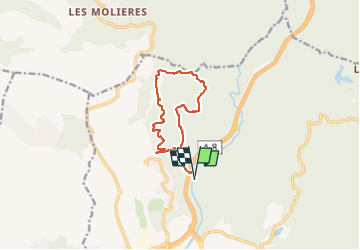

Length
11.2 km

Max alt
188 m

Uphill gradient
359 m
Km-Effort
16 km

Min alt
27 m

Downhill gradient
359 m
Boucle
Yes
Creation date :
2025-04-02 08:20:09.463
Updated on :
2025-04-02 08:21:30.941
3h38
Difficulty : Medium

FREE GPS app for hiking
 SityTrail
IGN / Geographical institutes
SityTrail Plus
The world is yours!
About
Trail Walking of 11.2 km to be discovered at Provence-Alpes-Côte d'Azur, Var, Fréjus. This trail is proposed by Michel DUBOIS.
Description
si pas d'eau au gué
Positioning
Country:
France
Region :
Provence-Alpes-Côte d'Azur
Department/Province :
Var
Municipality :
Fréjus
Location:
Unknown
Start:(Dec)
Start:(UTM)
317450 ; 4817365 (32T) N.
Comments