


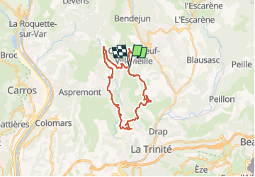
Boucle Macaron par la baisse de Bordinas

franquen
User

Length
27 km

Max alt
733 m

Uphill gradient
754 m
Km-Effort
38 km

Min alt
239 m

Downhill gradient
755 m
Boucle
Yes
Creation date :
2025-04-03 07:46:56.89
Updated on :
2025-04-04 11:55:07.7
3h21
Difficulty : Easy

FREE GPS app for hiking
 SityTrail
IGN / Geographical institutes
SityTrail Plus
The world is yours!
About
Trail Electric bike of 27 km to be discovered at Provence-Alpes-Côte d'Azur, Maritime Alps, Châteauneuf-Villevieille. This trail is proposed by franquen.
Description
Belle descente du mont Macaron avec une vue de Nice et de la côte. retour un peu chiant car que du bitume
Positioning
Country:
France
Region :
Provence-Alpes-Côte d'Azur
Department/Province :
Maritime Alps
Municipality :
Châteauneuf-Villevieille
Location:
Unknown
Start:(Dec)
Start:(UTM)
362691 ; 4851114 (32T) N.
Comments