


Saint Hilaire la Forêt Est

Gascon
User
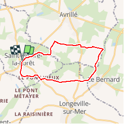

Length
12.1 km

Max alt
24 m

Uphill gradient
83 m
Km-Effort
13.2 km

Min alt
3 m

Downhill gradient
83 m
Boucle
Yes
Creation date :
2017-06-03 00:00:00.0
Updated on :
2017-06-03 00:00:00.0
2h54
Difficulty : Easy

FREE GPS app for hiking
 SityTrail
IGN / Geographical institutes
SityTrail Plus
The world is yours!
About
Trail Walking of 12.1 km to be discovered at Pays de la Loire, Vendée, Saint-Hilaire-la-Forêt. This trail is proposed by Gascon.
Positioning
Country:
France
Region :
Pays de la Loire
Department/Province :
Vendée
Municipality :
Saint-Hilaire-la-Forêt
Location:
Unknown
Start:(Dec)
Start:(UTM)
613273 ; 5144881 (30T) N.
Comments
bcp de zones goudronnées et dangereuses le long des départementales. aucun intérêt majeur : dommage de passer à côté des sites historiques !