


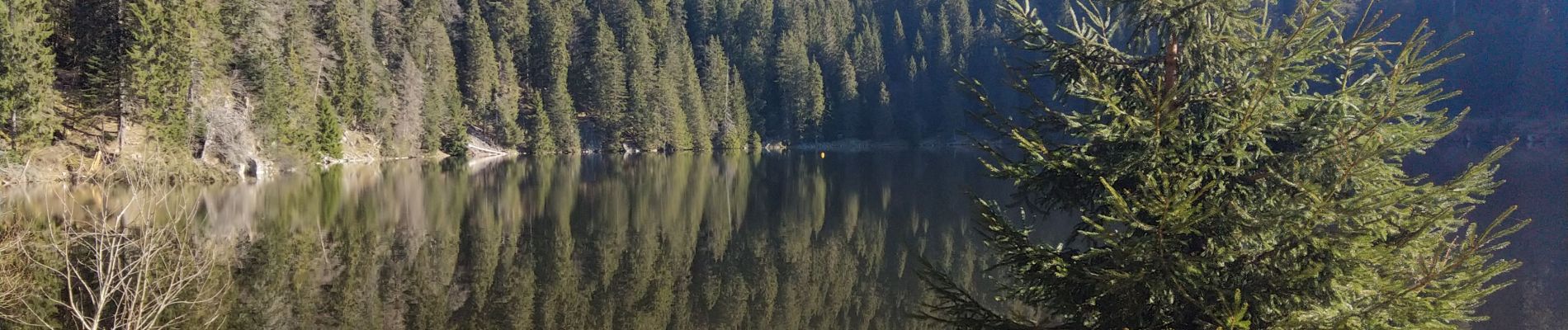
lac vert Haut Rhin

lepompi
User
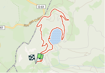

Length
5 km

Max alt
1233 m

Uphill gradient
200 m
Km-Effort
7.7 km

Min alt
1053 m

Downhill gradient
200 m
Boucle
Yes
Creation date :
2025-04-04 07:25:13.801
Updated on :
2025-04-04 11:41:11.998
1h53
Difficulty : Medium

FREE GPS app for hiking
 SityTrail
IGN / Geographical institutes
SityTrail Plus
The world is yours!
About
Trail Walking of 5 km to be discovered at Grand Est, Haut-Rhin, Soultzeren. This trail is proposed by lepompi.
Description
petite montagne..bons sentiers
Photos


Positioning
Country:
France
Region :
Grand Est
Department/Province :
Haut-Rhin
Municipality :
Soultzeren
Location:
Unknown
Start:(Dec)
Start:(UTM)
355398 ; 5327396 (32U) N.
Comments